Bandar Baharu (Bandar Baharu)
The Bandar Baharu District (colloquially Bandaq Baqhu or Bandaq Baru; once proposed to be renamed as Bandar Crustacea ) is a town, district and state assembly constituency at the southernmost end of Kedah, Malaysia. Bandar Baharu is located along the Kedah-Penang–Perak border tripoint, 37 km southeast of George Town, Penang's capital city.
Due to its closer proximity to Penang, Bandar Baharu is also part of Greater Penang, Malaysia's second largest conurbation, with the town's logistical needs being met by Penang's well-developed transportation infrastructure.
The Bandar Baharu District Council (Majlis Daerah Bandar Baharu, MDBB) administers the whole Bandar Baharu district. It covers an area as wide as 169.3 km2 and consists of seven sub-districts which are Serdang, Kuala Selama, Sungai Batu, Bagan Samak, Permatang Pasir, Sungai Kecil Ilir and Relau. Serdang, a 20 km drive away from the actual Bandar Baharu town, is the administrative town of Bandar Baharu district. It is the southernmost and second smallest local government area in Kedah.
Bandar Baharu district have
borders with South Seberang Perai in the east, Larut, Matang and Selama and Kerian districts in the south and Kulim district in the north.
Bandar Baharu District is divided into 6 mukims, which are:
* Bagan Samak
* Relau
* Selama
* Serdang
Map - Bandar Baharu (Bandar Baharu)
Map
Country - Malaysia
 |
 |
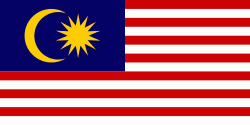
| Flag of Malaysia | |
Malaysia has its origins in the Malay kingdoms, which, from the 18th century on, became subject to the British Empire, along with the British Straits Settlements protectorate. Peninsular Malaysia was unified as the Malayan Union in 1946. Malaya was restructured as the Federation of Malaya in 1948 and achieved independence on 31 August 1957. The independent Malaya united with the then British crown colonies of North Borneo, Sarawak, and Singapore on 16 September 1963 to become Malaysia. In August 1965, Singapore was expelled from the federation and became a separate independent country.
Currency / Language
| ISO | Currency | Symbol | Significant figures |
|---|---|---|---|
| MYR | Malaysian ringgit | RM | 2 |
| ISO | Language |
|---|---|
| ZH | Chinese language |
| EN | English language |
| MS | Malay language |
| ML | Malayalam language |
| PA | Panjabi language |
| TA | Tamil language |
| TE | Telugu language |
| TH | Thai language |


